Sunday 15 February 2009

Higher Shelf Stones and Bleaklow Head from Old Glossop 14/2/09

This route started from Shepley Street in Old Glossop. I began following the track that led to the Doctors Gate path, which follows the course of an old Roman Road crossing the Pennines. Most of the snow had gone at this level, although there was a great deal of hard glassy ice that had frozen solid on the track. The view looking up the valley where I was heading had a light covering of snow. The patches of moor which showed through the snow seemed to add more definition to the landscape.


Track leading to Doctors Gate - course of Roman Road.

As I progressed further along the valley, the track turned into a narrow path which followed the course of the stream. The snow was getting thicker and deeper in places which made progress a bit awkward. Very soon the path would cross to the other side of the stream and start gaining height gradually on the other side of the valley. I had originally intended to take this route. However, not fancying the prospect of walking along an icy narrow path with a steep drop on one side, I decided to alter my route. This involved a steep direct ascent on my immediate left, up towards James's Thorn and then onto Lower Shelf Stones.


View from the ascent of James's Thorn. The Doctors Gate path traverses the right hand wall of the main valley gaining height all the time, until it reaches a shelf at the head of the valley where it joins the Pennine Way near the summit of the Snake Pass road.

As I gained height I got a great view of the valley as you can see from the photograph above. The climb was made a bit tricky by patches of deep snow which were to become thicker as I approached James's Thorn. At the top of the climb I followed the contour of the edge towards Lower Shelf Stones which was going to involve another short climb.
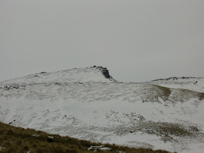


Photographs of approach to Lower Shelf Stones.

Just before the climb, I had a bank of snow to 'wade' through, where the snow was over knee deep. Once I reached the Lower Shelf Stones, I stopped a short while to take some photographs.

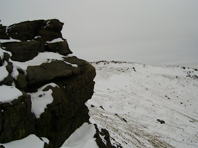

From here it was just a short round to Higher Shelf Stones where I took more photographs and sat down in the freezing cold to eat my lunch. The view from there over towards Kinder Scout North Edge was fantastic. It looked a real mountain from this point. The pictures below don't do it full justice.
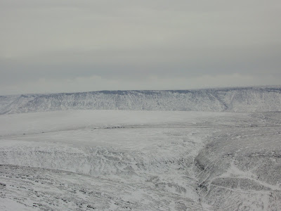


View of Kinder North Edge (above left). Trig Point at Higher Shelf Stones (above right).


View of Lower Shelf Stones from Higher Shelf Stones (above left). Frozen Rocks at Higher Shelf Stones (above right).


Fairbrook Naze from Higher Shelf Stones.

Although Higher Shelf Stones has its own trig point and is higher than the surrounding area on all sides, it is not the summit of Bleaklow itself. This requires crossing an area of moorland and peak hags which goes down an incline before rising to higher ground. Even so, I could not tell where the actual summit was from where I was standing, and since there are no paths on Bleaklow I had to use my compass to take a bearing.

From here was route was going to take me to the Hern Stones and then onto the Wainstones and Bleaklow Head. I could see both sets of rocks, but not Bleaklow Head which is the real summit. So I set off to my first destination across the snow covered rough ground. Normally the peat would be dark brown or almost black, but today the moorland landscape was brilliant white all around. I stopped at the Hern Stones to take a photo. There was a photographer on the other side of the rock taking some landscape shots across the moorland. Well actually he was having a break, drinking a warm drink and looking very comfortable just enjoying being there.


Hern Stones (left). Frozen Bleaklow landscape (right).

After exchanging greetings I set off across to the Wainstones. I could see them clearly in the distance when I set off, but the land dropped down further so they were not visible as I negotiated the snow and peat hags. It wasn't until I actually reached them that they suddenly reappeared after climbing a short section of rising ground. There were two groups of people around the area, and since I wanted to take some photo's of the rocks I decide to walk onto Bleaklow Head which was a five minute walk from there, and then return to the stones later.

Bleaklow Head is a wide area of flat peat with a pile of stones and a stake. Although it does not sound much, the area is very atmospheric; the snow and grey sky seemed to enhance this impression. I had this 'summit' to myself, and stopped a short while to take in the scenery and landscape. The sky was becoming even more dull and every now and then I could feel a small flake of hard snow landing on my face. Visibility was also deteriorating in the distance.
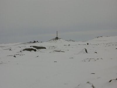


Summit cairn at Bleaklow Head

I then retraced my steps back to the Wainstones where the last group of people were just leaving. This gave me the opportunity to take the photograph below which needed to be from a precise angle for it to look like this:


These rocks were shaped naturally by the weather of course.

Now that I had got the picture that I had been planning to take the whole day, I took another bearing, and headed off west across the pathless moorland to descend by Yellowslacks brook and Shelf Benches. This is a fascinating area of Bleaklow where the gradual moorland slope drops suddenly and sharply, and the watercourse cuts a sharp curving valley which eventually leads to the main Doctors Gate valley where I had been earlier in the day. On the eastern side of this tributary valley there are a various shelves of rocks and land. It reminds me of a miniature Grand Canyon, although that is just my personal perception. Before descending I took this photograph across the upper part of yellowslacks to Dog Rock:


And this is the view looking up yellowslacks from the track leading to Doctors Gate:


Shelf Benches, where I make my descent, can be seen on the right of the photograph.

Neither photograph does it true justice. Its one of those places that you just need to see in person.

I descended a steep rocky slope to reach a flat plateau where I found a path going towards a rocky edge ahead. The land then dropped slightly to Wigan Clough before rising to the higher land of Shelf Benches. From here I descended a slope to get back onto the Doctors Gate track which I followed back to Old Glossop where I started my walk.

Sunday 18 January 2009

Hayfield to South Head and Kinder Low 17/1/08

This walk started from the car park at Hayfield opposite the campsite. I followed the country road over Bowden Bridge. It had rained overnight and the day had started off slightly overcast. My first destination was Mount Famine - a great view point for the Kinder Scout range and South Head.


From the north Mount Famine looks like a sharp peak, but this is just the start of a grassy ridge that continues to rise in height to its true summit. Here there is a weathered rocky edge characteristic of the Peak District.


The wind was rather blustery, but the cloud was clearing, and by the time I took the photo's above, the sun had come out, and the sky was mainly blue. There was just the odd thin cloud here and there.

My next destination was South Head. This involved a descent off the ridge to meet up with a narrow track. After a five minute walk, I left the track to climb grassy path up to the summit of South Head. This was surprisingly steep, as was the ascent of Mount Famine. When I reached the summit cairn, I got a great view all around.


After stopping a while to take in the great views, I descended the summit and headed east across moorland towards Brown Know. The ground was very waterlogged and there were frequent peak bogs that required hopping over.


As the land rose at Brown Knoll, the path turned north bypassing the summit to head towards Kinder Scout at Swines Back. This area provided a great view of Pym Chair rocks above Jaccobs Ladder, the steep path leading up from the Vale of Edale.


Eventually the path met up with the Pennine Way at the top of Jaccobs Ladder and as it ascended Kinder Scout. This involved a moderately steep climb up towards Edale Rocks and the trig point at Kinder Low.


From here the path crossed the western edges of Kinder Scout to Kinder Dowfall and Sandy Hays. I descended the ridge at Sandy Hays to the Reservoir at the bottom of William Clough. I stood looking back towards the western edges. It seemed really peaceful here listening to the sound of water lapping into the bank below the path. The scene was profoundly inspiring.

Wednesday 31 December 2008

Fairbrook Naze & Kinder Scout from the Snake Pass Inn 31/12/08

I started this walk from a lay by near the Snake Inn on the A57 Snake Pass Road. It had been foggy on the motorway on my journey to the Peak District, but this had cleared as I approached the Pennines. It was now sunny although the air was cold and frosty as I walked through the woodlands valley and crossed the wooden bridge over the River Ashop.

My first goal was the climb to Fairbrook Naze. I decided to take the direct route to the Naze itself rather than following the path by the Stream. This involved walking through heather moorland to get to the foot of the climb.


Fairbrook Naze itself is on the eastern tip of Kinder North Edge. It is shaped like a giant V with a ridge running up the middle. My route followed this ridge which was rather steep with rocky outcrops and boulders.


As the climb levelled out towards the top I paused to take in the view. A Cloud Inversion had been forming further down the Woodlands Valley and it was gradually becoming an impressive sight.


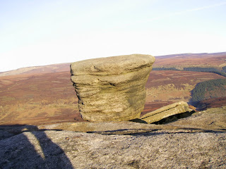
The top of Fairbrook Naze itself is a facinating area of Kinder Scout. There are rocky outscrops, a gritstone rock pedestal shaped by the weather, rocky ledges and the most unusual rock formations.

Gritstone Rock Pedestal at Fairbrook NazeRocky Outcrop on Fairbrook Naze

Fairbrook Naze is also a brilliant view point looking over towards the moorland of Bleaklow and down the Woodlands Valley towards Ladybower Reservoir where, today, the inversion had formed.


The next stage of my walk was across the Peat Channels of Kinder Plateau to join up with the river Kinder at at Kinder Gates. To begin with I followed the channel cut by the River Fairbrook before turing off to cut across the groughs. The sun was shinning brightly, and everywhere was very silent. Much of the peat was frozen hard. I had been walking for 20 minutes across this rough terrain when the ground levelled out and became a flat layer of peat and glassy ice. When I stopped walking to take in the sight, I could hear the ground all around me cracking as frozen earth was thawing under the winter sun.

As I pressed on the ground turned to rough peak channels, and I eventually joined with the River Kinder just before the huge gritstone rocks of Kinder Gates, between which the frozen river course passed.


From here I walked alongside the sandy river bed,crossing the ice here and there to find the best path. Eventually I arrived at Kinder Downfall and the western edge of the Kinder Plateau.

Kinder Downfall is where the River Kinder reaches the edge of the plateau and pours over the rocky cliffs at the apex of an inverted v. When I visited this sport two days earlier there was a strong easterly wind and freezing temperatures. Today, however, there was no wind, and the sun shone warm and bright. I sat on a rock facing south east looking across the High Peak area of the district.


when I first got there mist had already started to settle lower down in the valleys. Gradually more mist formed and the hill tops started to look like islands across a sea of white. The white stretched over the whole of the Cheshire Plane towards Wales on the far horizon. I have been to this area many times over the years but I had never seen the view looking like this:


After I finished my lunch I set off north west along the Plateau Edge. I looked back frequently to see the the white blanket of cloud covering the landscape. If anything the low cloud seemed to be getting thicker and more atmospheric. It was a shame when I reached the north western tip of the plateau and turned east along the Kinder North Edge, leaving this scene behind.

The north edge of Kinder is really impressive itself, of course. I was there two days ago traveling in the opossite direction. As I mentioned before the weather conditions were differnet that day. Today, looking over heather moorland to the north was very clear and visibility was good. I gradually made my way across the rocks, bolders and peat hags back towards Fairbrook Naze where my journey over Kinder Scout began earlier in the day.

Once there I stopped to look east down the Woodland Valley. The cloud Inversion from the morning had become thicker and had now reached the the River Fair Brook below Fairbrook Naze where I stood. After taking in this amazing scene, I retraced my steps down the ridge from the morning, and headed down into the freezing mist and back to the Woodlands Valley where I started my walk.

Saturday 27 December 2008

Kinder Scout via Harry Hut Sat 27th December 2008

This walk started from the lay by close to the Grouse Inn on the Glossop to Hayfield Road. Once across the stile I was on open moorland heading east towards my first goal which was the hill of Harry Hut. This was just a gentle 15 minute walk from the car park.

The summit of Harry Hut offered great views of Bleaklow to the north east and the back of Coombes Rocks to the west. I could also see the edge of the Kinder Plateau in the distance. The weather was a mixture of clear sky and hazy cloud with shafts of light illuminating different areas of moorland and fell.

Harry Hut

From Harry Hut I headed south east across moorland towards Mill Hill. The ground was frozen solid and the heather moorland had a white frosty coating. This made crossing the peat bogs much easier - normally you could sink in mud up to your knees if you didn't tread carefully. Once at Mill Hill I could see the steep ascent to the Kinder Plateau. Kinder seemed to tower above the ground below.

Mill HillKinder Scout

The ground here was very exposed to the strong easterly wind which was now quite strong. Climbing up the steep ascent the wind became stronger still and walking along the Kinder Scout western edge became very difficult as a result. The ground hear was strewn with gritstone boulders and there were numerous rocky outcrops along the edge. The white frosty coating became more prevalent once I passed Sandy Heys and headed towards Kinder Downfall.

Kinder Downfall itself was mainly frozen with just a small stream pouring over the edge. The sky hear seemed a dark bluish grey, and the wind was bitterly cold. From here I followed the River Kinder heading towards the middle of the plateau. I passed through the Kinder Gates, two extremely large bolder on either side of the frozen river. Then following a peat channel, I left the river to head north to get to Fairbrook Naze and the Kinder North Edge.

After climbing up down over and through the complex of peat hags, I eventually found the River Fairbrook which I followed before it drained over the edge of the Plateau. Fairbrook Naze itself is a rocky v shaped outcrop that looks down into the Ashop valley across the snake pass. Looking East the cloud seemed to hang in the valley in the far distance. The bluish Gray sky seemed to be darker in that direction as light mist swept across the plateau to my right.

After a short stop to view the scenery of the Seal Stones further down the plateau edge I turned west to walk along Kinder North Edge. Here the wind was behind me and the sky seemed brighter in that direction. The edge was on my right and looked down over Black Ashop Moor towards Featherbed Moss. Walking along this intermittent path involved traversing rocky outcrops, peak hags, boulders and streams. It is a facinating area of Kinder Scout and relatively quiet compared to the Pennine Way sections.

Towards the end of this section the rocky edge became a steep grassy slope with some outcrops and boulders hear and there. Eventually I reached the steep slope on the north Western corner of Kinder Scout that I had climbed up to get onto the plateau a couple of hours ago. The sun was now low in the sky and the wind had dropped. I climbed back down and headed back to Mill Hill before turning off the Pennine Way to retrace my steps to Harry Hut and the start of my walk.

Kinder North EdgePennine Way heading north towards Featherbed Moss

Tuesday 16 December 2008

Coombes Rocks and Lantern Pike Sun 14/12/08

I set off towards the Peak District early on Sunday morning. It was a foggy journey along the motorway. Luckily the fog seemed to have cleared by the time I was driving up the Monks Road that traverses the summit of the Coombes Rocks (sometimes refered to as Crown Edge). Right at the summit there is a layby where I parked up to check out the view. Looking back towards the Etherow Valley where I had driven through fog I was supprised to see an amazing cloud inversion. Here it is:

Cloud Inversion over the Etherow Valley


The start of my walk was a mile further down the road on the other side of the summit. The view on the easter side of Coombes Rock is across heather moorland to the higher fells of the Dark Peak - Kinder Scout, Bleaklow, and Black Hill. Today I was just going to tackle the small summit of Lantern Pike, returning through Rowarth and the southern half of Coombes Rocks.

I set out across the matley moor to join a track that took me to the foot of lantern pike.


It just a short steep pull up to the summit. Once climbed though, there are fantastic views over towards Kinder Scout. Today the clouds were too low to see the top of the kinder platau, but it was still an impressive scene.